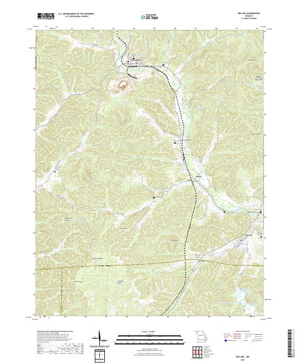
2021 Map of Des Arc
USGS Topo · Published 2021About this map
Annapolis and Des Arc anchor this corner of the Missouri Ozarks, illustrating a settlement pattern defined by the drainage of Big Creek and its many tributaries. The area is characterized by a dense network of family-named hollows and ridges, including Dafron Hollow and Long Ridge, which reveal the deep-rooted local geography of Iron, Reynolds, and Wayne Counties. Small communities like Vulcan and Slabtown Valley are connected by a web of county roads such as Co Rd 144 and Co Rd 155, while numerous burial grounds like Lewis Cem and Wallace Cem provide critical touchstones for genealogists. To the southeast, the Seven Lakes Reservoir system stands as a distinct topographical feature against the rising elevations of the Saint Francois Mountains, while landmarks like Stony Mtn and Ruble Mtn overlook the winding creek beds that shaped the early development of these valley towns.
Find a feature on this map
74 named features on this map. Tap any name to fly to it.
Don’t see what you’re looking for? This feature index may not catch every label — zoom into the map to look around manually.
Map Details
Editions of this 2021 Des Arc Map
This is the sole edition of this map. No revisions or reprints were ever made.
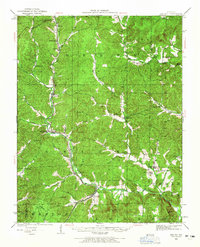
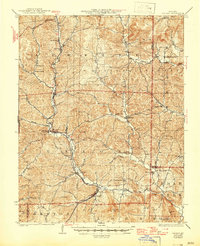
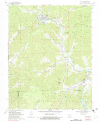
Historical Maps of Annapolis Through Time
4 maps found