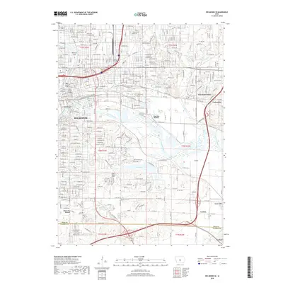
2018 Map of Des Moines SE
USGS Topo · Published 2018About this map
The Des Moines River and Raccoon River converge at the heart of this central Iowa landscape, framing the industrial and residential growth of the state capital. Modern infrastructure is evident in the numerous crossings like the Grand Avenue Bridge and the Southwest Fifth Street Bridge, while historical preservation is marked by the Owens Covered Bridge near Lake Easter. The map reveals the city's complex social history through its burial grounds, including the Children of Israel Cem and Laurel Hill Cem.
Find a feature on this map
44 named features on this map. Tap any name to fly to it.
Don’t see what you’re looking for? This feature index may not catch every label — zoom into the map to look around manually.
Map Details
Editions of this 2018 Des Moines SE Map
This is the sole edition of this map. No revisions or reprints were ever made.
Other maps of this area

1905 · Des Moines
USGS Topo · 1:62,500

1907 · Des Moines
USGS Topo · 1:62,500

1910 · Milo
USGS Topo · 1:62,500

1930 · Mitchellville
USGS Topo · 1:62,500

1931 · Indianola
USGS Topo · 1:62,500

1954 · Des Moines
USGS Topo · 1:250,000

1956 · Des Moines
USGS Topo · 1:250,000

1956 · Des Moines NW
USGS Topo · 1:24,000

1956 · Des Moines SW
USGS Topo · 1:24,000

1956 · Des Moines SE
USGS Topo · 1:24,000