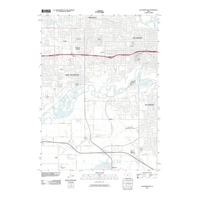
2010 Map of Des Moines SW
USGS Topo · Published 2010About this map
Des Moines and its southwestern suburbs are defined by the convergence of the Des Moines River and the Raccoon River as they appeared in 2010. The landscape reveals a complex network of residential developments and historic green spaces, including the sprawling Glendale Cemetery and the academic grounds of Drake University. The influence of these waterways is evident in the sprawling Water Works Park and the low-lying recreational areas surrounding Grays Lake.
Find a feature on this map
52 named features on this map. Tap any name to fly to it.
Don’t see what you’re looking for? This feature index may not catch every label — zoom into the map to look around manually.
Map Details
Editions of this 2010 Des Moines SW Map
This is the sole edition of this map. No revisions or reprints were ever made.
Other maps of this area

1905 · Des Moines
USGS Topo · 1:62,500

1907 · Des Moines
USGS Topo · 1:62,500

1908 · Waukee
USGS Topo · 1:62,500

1931 · Indianola
USGS Topo · 1:62,500

1951 · St. Charles
USGS Topo · 1:62,500

1954 · Des Moines
USGS Topo · 1:250,000

1956 · Des Moines
USGS Topo · 1:250,000

1956 · Des Moines NW
USGS Topo · 1:24,000

1956 · Des Moines SW
USGS Topo · 1:24,000

1956 · Des Moines SE
USGS Topo · 1:24,000