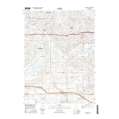
2015 Map of Des Moines SW
USGS Topo · Published 2015About this map
The Raccoon River and Walnut Cr define the central landscape of this southwestern Des Moines region, where dense urban grids transition into more open industrial and recreation zones. In the heart of the city, Drake Univ and Woodland Cem stand as established institutions, while the expansive Water Works Park preserves significant riverfront acreage. Further south, the extensive infrastructure of the Des Moines International Airport dominates the area above the Polk Co and Warren Co line. Neighborhoods like Windsor Heights and Clive show the 21st-century residential footprint, grounded by long-standing landmarks such as Glendale Cem. The Union Pacific rail corridor cuts through West Des Moines, marking the enduring transport network that connects these communities. The southern reaches are characterized by newer developments around Lakewood and the waters of Lake Colechester.
Find a feature on this map
126 named features on this map. Tap any name to fly to it.
Don’t see what you’re looking for? This feature index may not catch every label — zoom into the map to look around manually.
Map Details
Editions of this 2015 Des Moines SW Map
This is the sole edition of this map. No revisions or reprints were ever made.
Other maps of this area

1905 · Des Moines
USGS Topo · 1:62,500

1907 · Des Moines
USGS Topo · 1:62,500

1908 · Waukee
USGS Topo · 1:62,500

1931 · Indianola
USGS Topo · 1:62,500

1951 · St. Charles
USGS Topo · 1:62,500

1954 · Des Moines
USGS Topo · 1:250,000

1956 · Des Moines
USGS Topo · 1:250,000

1956 · Des Moines NW
USGS Topo · 1:24,000

1956 · Des Moines SW
USGS Topo · 1:24,000

1956 · Des Moines SE
USGS Topo · 1:24,000