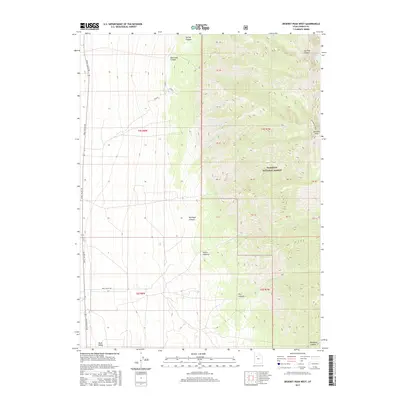
2017 Map of Deseret Peak West
USGS Topo · Published 2017About this map
Deseret Peak dominates this 2017 survey, marking a prominent high point along the Stanbury Crest in Tooele County. The eastern half of the map is defined by the steep, drainage-cut slopes of the Wasatch National Forest, where water features like S Willow Lake and Upper Spring provide essential moisture in a high-elevation desert environment. To the west, the terrain levels out into the broad expanse of Skull Valley, a stark contrast to the vertical relief of the mountains.
Find a feature on this map
33 named features on this map. Tap any name to fly to it.
Don’t see what you’re looking for? This feature index may not catch every label — zoom into the map to look around manually.
Map Details
Editions of this 2017 Deseret Peak West Map
This is the sole edition of this map. No revisions or reprints were ever made.
Other maps of this area

1885 · Tooele Valley
USGS Topo · 1:250,000

1953 · Tooele
USGS Topo · 1:250,000

1955 · Tabbys Peak SE
USGS Topo · 1:24,000

1955 · Timpie
USGS Topo · 1:62,500

1955 · Deseret Peak
USGS Topo · 1:62,500

1955 · Tooele
USGS Topo · 1:250,000

1973 · Hickman Knolls
USGS Topo · 1:24,000
1973 · Hastings Pass SE
USGS Topo · 1:24,000

1979 · Rush Valley
USGS Topo · 1:100,000
1979 · Tooele
USGS Topo · 1:100,000