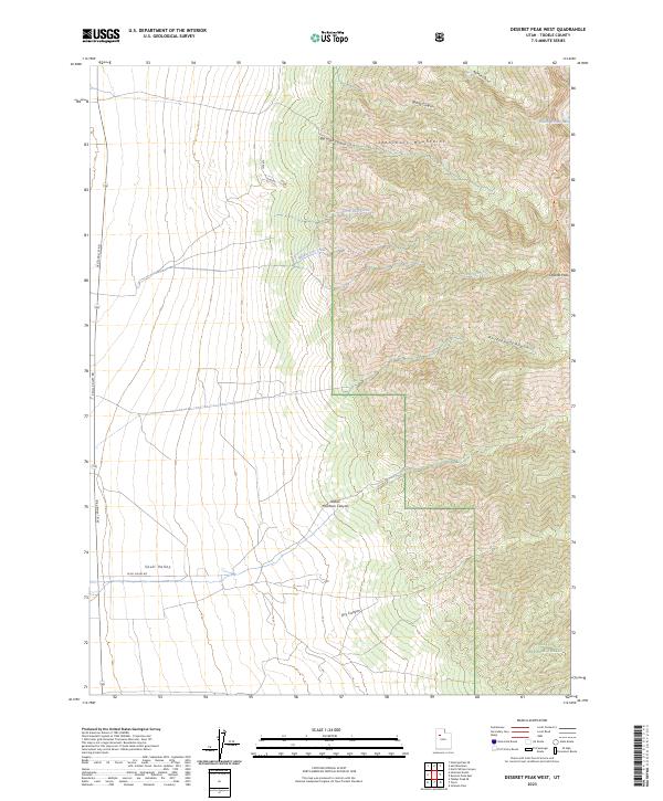
2023 Map of Deseret Peak West
USGS Topo · Published 2023About this map
The Stansbury Mountains define the central axis of this landscape, where high-elevation drainage systems like Big Creek Canyon and Antelope Canyon descend toward the valley floor. Dominating the eastern heights is Deseret Peak, the focal point of the Deseret Peak Wilderness and the broader Wasatch National Forest. To the west, the steep mountain front gives way to the open expanses of Skull Valley, a transition navigated by the long straightaway of Skull Valley Rd. This modern survey illustrates the essential water sources that sustain the region, from high-country features like South Willow Lake and Upper Spring to the seasonal flows within Indian Hickman Canyon and North Lost Creek. The map provides a clear look at the relationship between the protected alpine wilderness and the arid basins typical of Tooele County.
Find a feature on this map
17 named features on this map. Tap any name to fly to it.
Don’t see what you’re looking for? This feature index may not catch every label — zoom into the map to look around manually.
Map Details
Editions of this 2023 Deseret Peak West Map
This is the sole edition of this map. No revisions or reprints were ever made.
Other maps of this area

1885 · Tooele Valley
USGS Topo · 1:250,000

1953 · Tooele
USGS Topo · 1:250,000

1955 · Tabbys Peak SE
USGS Topo · 1:24,000

1955 · Timpie
USGS Topo · 1:62,500

1955 · Deseret Peak
USGS Topo · 1:62,500

1955 · Tooele
USGS Topo · 1:250,000

1973 · Hickman Knolls
USGS Topo · 1:24,000
1973 · Hastings Pass SE
USGS Topo · 1:24,000

1979 · Rush Valley
USGS Topo · 1:100,000
1979 · Tooele
USGS Topo · 1:100,000