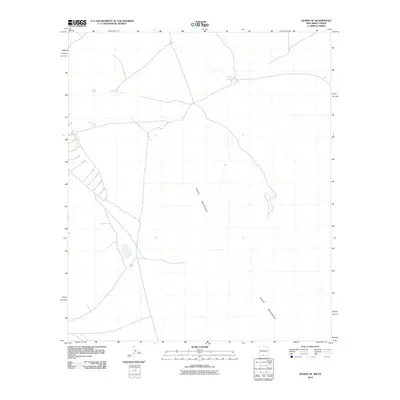
2010 Map of Desert SE
USGS Topo · Published 2010About this map
The Hueco Mountains define the central and southeastern reaches of this arid landscape on the border of New Mexico and Texas. This high-desert terrain is characterized by sparse water resources, with Flat Tank serving as a localized point of interest in the northern portion of the quadrangle. The map documents a network of primitive roads and tracks that navigate the slopes and flats surrounding the mountain range, reflecting the area's remote character and its proximity to the state line. Topographic data from 2010 illustrates the relationship between these physical barriers and the simple infrastructure required to traverse this section of Otero County.
Find a feature on this map
2 named features on this map. Tap any name to fly to it.
Don’t see what you’re looking for? This feature index may not catch every label — zoom into the map to look around manually.
Map Details
Editions of this 2010 Desert SE Map
This is the sole edition of this map. No revisions or reprints were ever made.
Other maps of this area

1896 · El Paso
USGS Topo · 1:125,000

1903 · Cerro Alto
USGS Topo · 1:125,000

1908 · El Paso
USGS Topo · 1:125,000

1939 · Heuco Tanks
USGS Topo · 1:62,500

1940 · Heuco Tanks
USGS Topo · 1:62,500

1940 · Bassett Lake
USGS Topo · 1:62,500

1941 · Heuco Mountains
USGS Topo · 1:62,500

1941 · Desert
USGS Topo · 1:62,500

1943 · Desert
USGS Topo · 1:62,500

1943 · Heuco Mountains
USGS Topo · 1:62,500