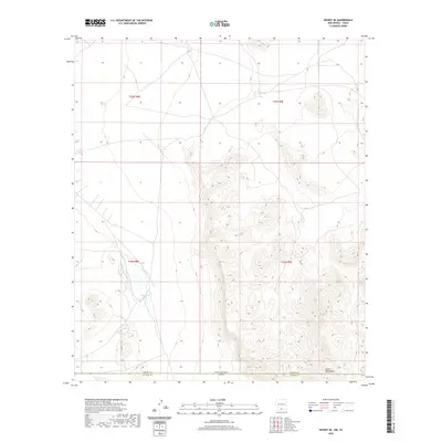
2020 Map of Desert SE
USGS Topo · Published 2020About this map
The Hueco Mountains define the high ground of this arid landscape along the border of New Mexico and Texas. This 2020 U.S. Geological Survey topographic record illustrates a sparsely settled region dominated by complex contour intervals and remote catchments. The terrain is marked by essential water features like Flat Tank in the north and Lake Tank further south, which serve as critical landmarks in an otherwise dry expanse. The southern edge of the sheet follows the administrative boundary between Otero County and El Paso County, where the state line of New Mexico and Texas is established. The absence of traditional settlements or infrastructure highlights the area's use for ranching or conservation, with the landscape segmented by the Public Land Survey System grids of t25s r8e, t25s r9e, t26s r8e, and t26s r9e.
Find a feature on this map
9 named features on this map. Tap any name to fly to it.
Don’t see what you’re looking for? This feature index may not catch every label — zoom into the map to look around manually.
Map Details
Editions of this 2020 Desert SE Map
This is the sole edition of this map. No revisions or reprints were ever made.
Other maps of this area

1896 · El Paso
USGS Topo · 1:125,000

1903 · Cerro Alto
USGS Topo · 1:125,000

1908 · El Paso
USGS Topo · 1:125,000

1939 · Heuco Tanks
USGS Topo · 1:62,500

1940 · Heuco Tanks
USGS Topo · 1:62,500

1940 · Bassett Lake
USGS Topo · 1:62,500

1941 · Heuco Mountains
USGS Topo · 1:62,500

1941 · Desert
USGS Topo · 1:62,500

1943 · Desert
USGS Topo · 1:62,500

1943 · Heuco Mountains
USGS Topo · 1:62,500