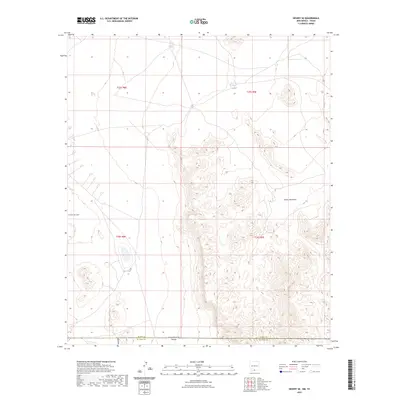
2023 Map of Desert SE
USGS Topo · Published 2023About this map
Fort Bliss dominates the western landscape of this high desert region along the border of Otero and El Paso Counties. The terrain is defined by the significant rise of the Hueco Mountains, which create a complex network of ridges and canyons in the eastern portion of the quadrangle. This area serves as a critical junction where New Mexico and Texas meet, reflecting the vast military and borderland geography of the American Southwest. Water features are sparse but essential landmarks in this arid environment, represented by catchment areas such as Lake Tank and Flat Tank. The survey clearly delineates the township and range system, including t25s r8e and t26s r9e, which provide a vital framework for understanding land use and jurisdictional boundaries in this sparsely populated border zone.
Find a feature on this map
10 named features on this map. Tap any name to fly to it.
Don’t see what you’re looking for? This feature index may not catch every label — zoom into the map to look around manually.
Map Details
Editions of this 2023 Desert SE Map
This is the sole edition of this map. No revisions or reprints were ever made.
Other maps of this area

1896 · El Paso
USGS Topo · 1:125,000

1903 · Cerro Alto
USGS Topo · 1:125,000

1908 · El Paso
USGS Topo · 1:125,000

1939 · Heuco Tanks
USGS Topo · 1:62,500

1940 · Heuco Tanks
USGS Topo · 1:62,500

1940 · Bassett Lake
USGS Topo · 1:62,500

1941 · Heuco Mountains
USGS Topo · 1:62,500

1941 · Desert
USGS Topo · 1:62,500

1943 · Desert
USGS Topo · 1:62,500

1943 · Heuco Mountains
USGS Topo · 1:62,500