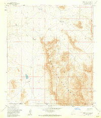
1955 Map of Desert SE
USGS Topo · Published 1962About this map
The Hueco Mountains dominate this 1950s survey of the high desert along the border of New Mexico and Texas. The landscape is defined by the vital necessity of water management in an arid climate, marked by a series of catchment features including Chaparral Tank, Flat Tank, Coyote Tank, and Lake Tank. These features suggest a history of ranching or livestock management in a region where natural surface water is scarce.
Find a feature on this map
11 named features on this map. Tap any name to fly to it.
Don’t see what you’re looking for? This feature index may not catch every label — zoom into the map to look around manually.
Map Details
Editions of this 1955 Desert SE Map
This is the sole edition of this map. No revisions or reprints were ever made.
Other maps of this area

1896 · El Paso
USGS Topo · 1:125,000

1903 · Cerro Alto
USGS Topo · 1:125,000

1908 · El Paso
USGS Topo · 1:125,000

1939 · Heuco Tanks
USGS Topo · 1:62,500

1940 · Heuco Tanks
USGS Topo · 1:62,500

1940 · Bassett Lake
USGS Topo · 1:62,500

1941 · Heuco Mountains
USGS Topo · 1:62,500

1941 · Desert
USGS Topo · 1:62,500

1943 · Desert
USGS Topo · 1:62,500

1943 · Heuco Mountains
USGS Topo · 1:62,500