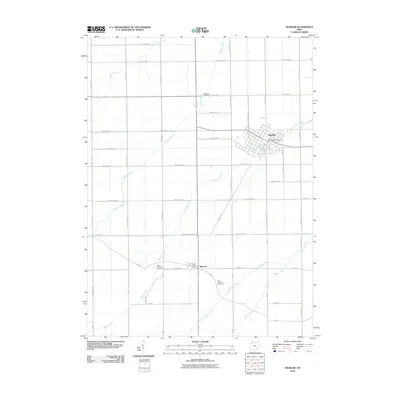
2010 Map of Deshler
USGS Topo · Published 2010About this map
Deshler and Belmore anchor this agricultural landscape in northwestern Ohio, where a dense grid of county roads defines the territory. The topography is shaped by a branching network of small waterways, including Hammer Creek, Brush Creek, and Little Yellow Creek, which cut through the level terrain. For genealogists and local historians, the map provides precise locations for the Deshler Post Office and the Belmore Post Office, alongside vital burial sites such as Woodlawn Cemetery and the West Belmore Cemetery. The settlement pattern follows a strict cardinally-aligned road system, with Road Y and Twp Hwy B serving as local connectors between farmsteads and the village centers. This 2010 survey reflects the enduring rural character of the region, maintained through established drainage ways like Beaver Creek and Yellow Creek.
Find a feature on this map
46 named features on this map. Tap any name to fly to it.
Don’t see what you’re looking for? This feature index may not catch every label — zoom into the map to look around manually.
Map Details
Editions of this 2010 Deshler Map
This is the sole edition of this map. No revisions or reprints were ever made.
Other maps of this area

1908 · Ottawa
USGS Topo · 1:62,500

1908 · Napoleon
USGS Topo · 1:62,500

1909 · Mc Clure
USGS Topo · 1:62,500

1953 · Fort Wayne
USGS Topo · 1:250,000

1956 · Fort Wayne
USGS Topo · 1:250,000

1956 · Toledo
USGS Topo · 1:250,000

1960 · Deshler
USGS Topo · 1:24,000

1960 · Ottawa
USGS Topo · 1:24,000
1960 · Hamler
USGS Topo · 1:24,000
1960 · Malinta
USGS Topo · 1:24,000