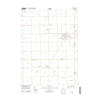
2013 Map of Deshler
USGS Topo · Published 2013About this map
Deshler sits at the northern heart of this landscape, its grid defined by streets like W Main St and E Maple St near the intersection of several regional routes. To the south, the village of Belmore is established along Road Y, characterized by its residential layout near W Belmore Cem and E Belmore Cem. This 2013 survey illustrates a predominantly agricultural region across Henry, Wood, and Putnam counties, where the straight lines of section roads like Co Road D and Co Road B contrast with the wandering paths of Beaver Cr, Hammer Cr, and Brush Cr. Local transportation and utility are evidenced by the Deshler Municipal Landing Strip on the eastern edge, while Woodlawn Cem serves as a localized landmark for genealogists tracing families in the northwestern part of the quadrangle.
Find a feature on this map
89 named features on this map. Tap any name to fly to it.
Don’t see what you’re looking for? This feature index may not catch every label — zoom into the map to look around manually.
Map Details
Editions of this 2013 Deshler Map
This is the sole edition of this map. No revisions or reprints were ever made.
Other maps of this area

1908 · Ottawa
USGS Topo · 1:62,500

1908 · Napoleon
USGS Topo · 1:62,500

1909 · Mc Clure
USGS Topo · 1:62,500

1953 · Fort Wayne
USGS Topo · 1:250,000

1956 · Fort Wayne
USGS Topo · 1:250,000

1956 · Toledo
USGS Topo · 1:250,000

1960 · Deshler
USGS Topo · 1:24,000

1960 · Ottawa
USGS Topo · 1:24,000
1960 · Hamler
USGS Topo · 1:24,000
1960 · Malinta
USGS Topo · 1:24,000