2023 Map of Deshler
USGS Topo · Published 2023About this map
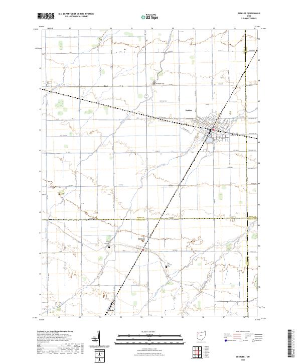
Deshler stands as a significant rural junction in northwestern Ohio, where the grid of the town center meets a landscape defined by drainage and agriculture. This modern survey shows the village's detailed street plan, including W Main St and Park St, as it transitions into the productive fields of Henry County. The surrounding countryside is marked by several community burial grounds, such as Woodlawn Cem to the west and the pair of West Belmore Cem and East Belmore Cem flanking the village of Belmore. The terrain is shaped by several meandering waterways, including Brush Creek and Hammer Creek, which cut across the high-contrast township lines. Moving south towards Leipsic, the map illustrates how the drainage network of Yellow Creek and Little Yellow Creek dictates the local geography, providing a clear record of the area's contemporary land use and small-town boundaries.
Find a feature on this map
83 named features on this map. Tap any name to fly to it.
Don’t see what you’re looking for? This feature index may not catch every label — zoom into the map to look around manually.
Map Details
Editions of this 2023 Deshler Map
This is the sole edition of this map. No revisions or reprints were ever made.
Other maps of this area

1908 · Ottawa
USGS Topo · 1:62,500

1908 · Napoleon
USGS Topo · 1:62,500

1909 · Mc Clure
USGS Topo · 1:62,500

1953 · Fort Wayne
USGS Topo · 1:250,000

1956 · Fort Wayne
USGS Topo · 1:250,000

1956 · Toledo
USGS Topo · 1:250,000

1960 · Deshler
USGS Topo · 1:24,000

1960 · Ottawa
USGS Topo · 1:24,000
1960 · Hamler
USGS Topo · 1:24,000
1960 · Malinta
USGS Topo · 1:24,000