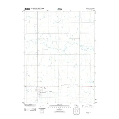
2011 Map of Deshler
USGS Topo · Published 2011About this map
Deshler occupies a central role in this modern Nebraska survey, situated where the grid of city streets meets the flowing waters of Spring Creek. The town's local history is anchored by the Deshler Post Office and nearby resting places including Peace Cemetery and Saint Peters Cemetery. The landscape is defined by its water systems, from the winding path of the Little Blue River in the north to the Wiedel Reservoir and Wiedel Dam in the southeast. While the town center follows a structured urban layout along 1st St and E Railway Ave, the surrounding terrain is dominated by agricultural drainage patterns, including the South Fork Big Sandy Creek and Dry Creek, illustrating the intersection of residential settlement and the hydraulic needs of the Plains.
Find a feature on this map
16 named features on this map. Tap any name to fly to it.
Don’t see what you’re looking for? This feature index may not catch every label — zoom into the map to look around manually.
Map Details
Editions of this 2011 Deshler Map
This is the sole edition of this map. No revisions or reprints were ever made.
Other maps of this area

1898 · Hebron
USGS Topo · 1:125,000

1955 · Lincoln
USGS Topo · 1:250,000

1957 · Lincoln
USGS Topo · 1:250,000

1958 · Lincoln
USGS Topo · 1:250,000

1960 · Bruning
USGS Topo · 1:24,000

1960 · Byron
USGS Topo · 1:24,000

1960 · Davenport
USGS Topo · 1:24,000

1960 · Chester
USGS Topo · 1:24,000

1960 · Carleton
USGS Topo · 1:24,000
1960 · Ruskin
USGS Topo · 1:24,000