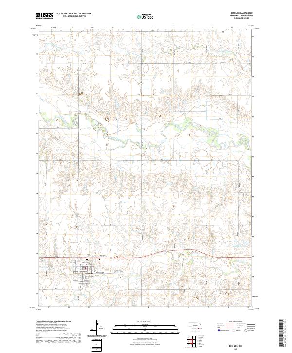
2021 Map of Deshler
USGS Topo · Published 2021About this map
Deshler serves as the central hub of this Thayer County landscape, where the residential street grid includes W Enola Ave, E Railway Ave, and Park St. The surrounding countryside is defined by the winding course of the Little Blue River and the steady flow of the S Fork Big Sandy Cr to the north. These waterways, along with Spring Cr and the Wiedel Reservoir, historically anchored the agricultural development of the region. Local history and genealogy are well-represented by the proximity of the Peace Lutheran Cem and Saint Peter Lutheran Cem, located just north of the main settlement. The map provides a clear look at the rural township structure, showing the intersection of section lines and gravel roads that have organized this Nebraska prairie for generations.
Find a feature on this map
28 named features on this map. Tap any name to fly to it.
Don’t see what you’re looking for? This feature index may not catch every label — zoom into the map to look around manually.
Map Details
Editions of this 2021 Deshler Map
This is the sole edition of this map. No revisions or reprints were ever made.
Other maps of this area

1898 · Hebron
USGS Topo · 1:125,000

1955 · Lincoln
USGS Topo · 1:250,000

1957 · Lincoln
USGS Topo · 1:250,000

1958 · Lincoln
USGS Topo · 1:250,000

1960 · Bruning
USGS Topo · 1:24,000

1960 · Byron
USGS Topo · 1:24,000

1960 · Davenport
USGS Topo · 1:24,000

1960 · Chester
USGS Topo · 1:24,000

1960 · Carleton
USGS Topo · 1:24,000
1960 · Ruskin
USGS Topo · 1:24,000