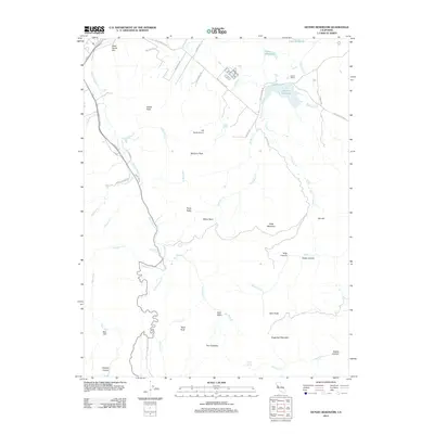
2012 Map of Detert Reservoir
USGS Topo · Published 2012About this map
Guenoc Winery and the surrounding viticultural landscape define this corner of Lake County, where the highlands of the Mayacamas Mountains meet the upper Napa Valley drainage. The terrain is characterized by dramatic elevation changes, notably The Palisades and Table Mountain, which overlook the complex network of creeks feeding into Detert Reservoir. A significant historical transport link, the Old Lawley Toll Rd, winds through the southwestern section of the map near Kimball Canyon, tracing the legacy of early regional commerce. Smaller aviation and agricultural interests are marked by the 7-M Ranch Airport and the high-altitude Dead Horse Flat. This geography illustrates the continued importance of water management and high-relief terrain in shaping Lake County's settlement patterns, from the banks of the Napa River to the shores of Lake Bordeaux.
Find a feature on this map
55 named features on this map. Tap any name to fly to it.
Don’t see what you’re looking for? This feature index may not catch every label — zoom into the map to look around manually.
Map Details
Editions of this 2012 Detert Reservoir Map
This is the sole edition of this map. No revisions or reprints were ever made.
Other maps of this area

1927 · Calistoga
USGS Topo · 1:62,500

1942 · St. Helena
USGS Topo · 1:62,500

1943 · Morgan Valley
USGS Topo · 1:62,500

1943 · Calistoga
USGS Topo · 1:62,500

1944 · Morgan Valley
USGS Topo · 1:62,500

1945 · Calistoga
USGS Topo · 1:62,500

1945 · St. Helena
USGS Topo · 1:62,500

1945 · Lower Lake
USGS Topo · 1:62,500

1947 · Santa Rosa
USGS Topo · 1:250,000

1949 · Santa Rosa
USGS Topo · 1:250,000