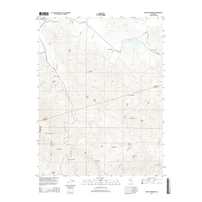
2015 Map of Detert Reservoir
USGS Topo · Published 2015About this map
The Palisades stand as a dominant geological feature in this portion of the Mayacmas Mountains, where the borders of Lake, Napa, and Sonoma counties meet. The landscape is defined by dramatic elevation changes, from the heights of McGuire Peak and Three Peaks down to the drainage of Saint Helena Cr and the Collayomi Valley. This map documents a region heavily influenced by its volcanic geology and hydrology, centered on the Detert Reservoir and the adjacent Lake Bordeaux and Lake Burgundy. The presence of the Oat Hill Mine Trail and Western Mine Rd reflects the area's industrial past, while the modern footprint is seen in thoroughfares like Guenoc Winery Rd. Notable landmarks such as Hole in the Rock, Table Rock, and Sugarloaf Mtn punctuate the ridges above Jericho Canyon and Bear Valley.
Find a feature on this map
67 named features on this map. Tap any name to fly to it.
Don’t see what you’re looking for? This feature index may not catch every label — zoom into the map to look around manually.
Map Details
Editions of this 2015 Detert Reservoir Map
This is the sole edition of this map. No revisions or reprints were ever made.
Other maps of this area

1927 · Calistoga
USGS Topo · 1:62,500

1942 · St. Helena
USGS Topo · 1:62,500

1943 · Morgan Valley
USGS Topo · 1:62,500

1943 · Calistoga
USGS Topo · 1:62,500

1944 · Morgan Valley
USGS Topo · 1:62,500

1945 · Calistoga
USGS Topo · 1:62,500

1945 · St. Helena
USGS Topo · 1:62,500

1945 · Lower Lake
USGS Topo · 1:62,500

1947 · Santa Rosa
USGS Topo · 1:250,000

1949 · Santa Rosa
USGS Topo · 1:250,000