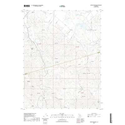
2018 Map of Detert Reservoir
USGS Topo · Published 2018About this map
The Palisades and Sugarloaf Mtn dominate the southern landscape of this 2018 survey, where the border of Lake and Napa Counties cuts across a complex network of canyons and peaks. The area around Oat Hill is marked by a legacy of mercury mining and early transportation, evidenced by the Oat Hill Mine Trail and the historic Old Lawley Toll Rd winding through the south-central hills. To the north, the terrain transitions into the Collayomi Valley and the waters of Detert Reservoir, which serves as a significant catchment in the drainage of Bucksnort Creek. The map details a rugged transition from the Mayacmas Mountains in the west toward the ranching and water resources of the interior valleys, including smaller bodies like Lake Bordeaux and springs such as Rattlesnake Spring.
Find a feature on this map
75 named features on this map. Tap any name to fly to it.
Don’t see what you’re looking for? This feature index may not catch every label — zoom into the map to look around manually.
Map Details
Editions of this 2018 Detert Reservoir Map
This is the sole edition of this map. No revisions or reprints were ever made.
Other maps of this area

1927 · Calistoga
USGS Topo · 1:62,500

1942 · St. Helena
USGS Topo · 1:62,500

1943 · Morgan Valley
USGS Topo · 1:62,500

1943 · Calistoga
USGS Topo · 1:62,500

1944 · Morgan Valley
USGS Topo · 1:62,500

1945 · Calistoga
USGS Topo · 1:62,500

1945 · St. Helena
USGS Topo · 1:62,500

1945 · Lower Lake
USGS Topo · 1:62,500

1947 · Santa Rosa
USGS Topo · 1:250,000

1949 · Santa Rosa
USGS Topo · 1:250,000