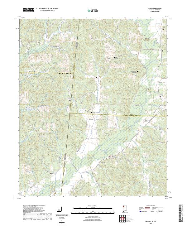
2024 Map of Detroit
USGS Topo · Published 2024About this map
Sipsey Creek and its many tributaries, including Northington Branch and Reedy Branch, define the rural landscape around the town of Detroit near the Mississippi and Alabama state line. This map details a high concentration of family and community burial grounds, which serve as vital markers for genealogical research in this border region. Settlements and homesteads are linked by a network of local roads such as Hatley Detroit Rd and Pearce Chapel Rd, tracing the movement of residents between Lamar Co and Marion Co. The terrain is deeply etched by a complex drainage system, where Dry Creek and Little Dry Creek converge south of the Monroe Co and Itawamba Co lines, illustrating the geographical factors that influenced early road placement and land use across multiple county boundaries.
Find a feature on this map
85 named features on this map. Tap any name to fly to it.
Don’t see what you’re looking for? This feature index may not catch every label — zoom into the map to look around manually.
Map Details
Editions of this 2024 Detroit Map
This is the sole edition of this map. No revisions or reprints were ever made.
Other maps of this area

1953 · West Point
USGS Topo · 1:250,000

1956 · Tupelo
USGS Topo · 1:250,000

1958 · Tupelo
USGS Topo · 1:250,000

1958 · West Point
USGS Topo · 1:250,000

1963 · West Point
USGS Topo · 1:250,000

1966 · Turon
USGS Topo · 1:24,000

1966 · Tremont
USGS Topo · 1:24,000

1966 · Greenwood Springs
USGS Topo · 1:24,000

1967 · Sulligent
USGS Topo · 1:24,000
1967 · Weston
USGS Topo · 1:24,000