
1966 Map of Tremont
USGS Topo · Published 1967About this map
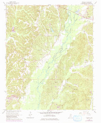
Bull Mountain Creek meanders through this portion of Itawamba County, Mississippi, defining a broad floodplain that separates the elevated terrain of Bull Mountain from the surrounding rural communities. The settlement of Tremont serves as a local hub near the Alabama border, while smaller hamlets like Tilden and Cadamy are connected by a network of unimproved roads and light-duty paths. The landscape in the mid-1960s was characterized by a mix of agricultural clearings and resource extraction, evidenced by numerous Gravel Pits, Claypits, and a series of Gas Wells concentrated in the west.
Find a feature on this map
35 named features on this map. Tap any name to fly to it.
Don’t see what you’re looking for? This feature index may not catch every label — zoom into the map to look around manually.
Map Details
Editions of this 1966 Tremont Map
2 editions found
Other maps of this area

1956 · Tupelo
USGS Topo · 1:250,000

1958 · Tupelo
USGS Topo · 1:250,000

1965 · Fulton SE
USGS Topo · 1:24,000

1965 · Fulton
USGS Topo · 1:24,000

1966 · Smithville
USGS Topo · 1:24,000

1966 · Beans Ferry
USGS Topo · 1:24,000

1966 · Turon
USGS Topo · 1:24,000
1967 · Shottsville
USGS Topo · 1:24,000
1967 · Bexar
USGS Topo · 1:24,000
1967 · Detroit
USGS Topo · 1:24,000