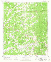
1967 Map of Weston
USGS Topo · Published 1968About this map
Hurricane Creek and its many tributaries carve through the upland landscape of Marion County in the late 1960s, defining a region of small, interconnected rural communities. Local life centers on a network of country churches and family burial grounds, such as Chestnut Grove Ch Cem and Palmer Ch Cem, which serve as vital landmarks for genealogists. The settlement at Weston appears as a quiet crossroads, while the larger town of Hamilton is visible on the eastern edge of the survey, complete with municipal infrastructure like a Water Tank and Radio Tower.
Find a feature on this map
40 named features on this map. Tap any name to fly to it.
Don’t see what you’re looking for? This feature index may not catch every label — zoom into the map to look around manually.
Map Details
Editions of this 1967 Weston Map
2 editions found
Other maps of this area

1936 · Hodges
USGS Topo · 1:24,000

1936 · Vina
USGS Topo · 1:24,000

1949 · Hodges
USGS Topo · 1:24,000

1950 · Vina
USGS Topo · 1:24,000

1951 · Vina
USGS Topo · 1:24,000

1956 · Gadsden
USGS Topo · 1:250,000

1956 · Tupelo
USGS Topo · 1:250,000

1958 · Tupelo
USGS Topo · 1:250,000

1958 · Gadsden
USGS Topo · 1:250,000

1960 · Gadsden
USGS Topo · 1:250,000