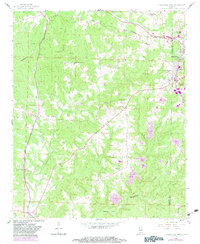
1958 Map of Haleyville West
USGS Topo · Published 1983About this map
Haleyville serves as the primary municipal center at the corner of Marion and Winston counties, where the Southern and Illinois Central Gulf railroads converge. The landscape is defined by the deep incisions of the Buttahatchee River and its various tributaries, including the West Branch Buttahatchee River and Clifty Creek. While the eastern portion of the map encompasses a section of the William B Bankhead National Forest, the western rural areas are dotted with small community landmarks such as Whitehouse and Goddard. Genealogists will find significant value in the numerous documented country churches and burial grounds, such as Ireland Memorial Ch and Old Ireland Cem. The presence of several strip mines and gravel pits around the periphery of Haleyville reflects the local extractive economy that shaped the region during the mid-20th century.
Find a feature on this map
44 named features on this map. Tap any name to fly to it.
Don’t see what you’re looking for? This feature index may not catch every label — zoom into the map to look around manually.
Map Details
Editions of this 1958 Haleyville West Map
3 editions found
Other maps of this area

1936 · Delmar
USGS Topo · 1:24,000

1936 · Kinlock Spring
USGS Topo · 1:24,000

1936 · Phil Campbell
USGS Topo · 1:24,000

1936 · South Of Hackleburg
USGS Topo · 1:24,000

1936 · Hackleburg
USGS Topo · 1:24,000

1936 · Goddard
USGS Topo · 1:24,000

1946 · Hackleburg
USGS Topo · 1:24,000

1946 · Phil Campbell
USGS Topo · 1:24,000

1947 · Phil Campbell
USGS Topo · 1:24,000

1947 · Kinlock Spring
USGS Topo · 1:24,000