
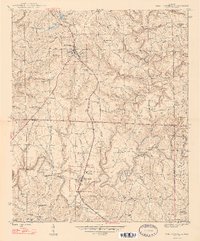
1947 Map of Phil Campbell
USGS Topo · Published 1947About this map
Phil Campbell serves as the primary rail-and-road hub in this 1946 survey, where the Southern railroad line intersects with local highways amidst the dissected uplands of northwest Alabama. The landscape transition from Franklin County into Marion and Winston counties is marked by a concentration of early industrial activity and rural community life. To the south, Bear Creek emerges as a significant settlement, home to the Phillips High Sch and multiple congregations such as Bear Creek Ch No 1.
Find a feature on this map
74 named features on this map. Tap any name to fly to it.
Don’t see what you’re looking for? This feature index may not catch every label — zoom into the map to look around manually.
Map Details
Editions of this 1947 Phil Campbell Map
2 editions found
Other maps of this area

1936 · Newburg
USGS Topo · 1:24,000

1936 · Delmar
USGS Topo · 1:24,000

1936 · Kinlock Spring
USGS Topo · 1:24,000

1936 · Isbell
USGS Topo · 1:24,000

1936 · Phil Campbell
USGS Topo · 1:24,000

1936 · South Of Hackleburg
USGS Topo · 1:24,000

1936 · Hackleburg
USGS Topo · 1:24,000

1936 · Spruce Pine
USGS Topo · 1:24,000

1936 · Goddard
USGS Topo · 1:24,000

1945 · Spruce Pine
USGS Topo · 1:24,000