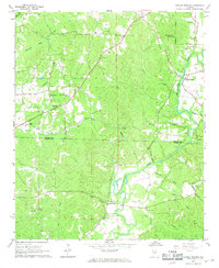
1967 Map of Henson Springs
USGS Topo · Published 1968About this map
Henson Springs and Aston serve as focal points for this 1967 survey of northwestern Alabama, where the winding Buttahatchee River carves through a landscape of creek-fed hollows. The settlement pattern reflects a deeply rooted rural community, with family and congregation names dotting the terrain at sites like Cedar Grove Ch and the Cantrell Cem Webb Ch. One of the most intriguing historical markers is the Old Treaty Bdy in the northwest corner, a remnant of early 19th-century tribal land cessions that still influenced local property lines and surveying decades later.
Find a feature on this map
33 named features on this map. Tap any name to fly to it.
Don’t see what you’re looking for? This feature index may not catch every label — zoom into the map to look around manually.
Map Details
Editions of this 1967 Henson Springs Map
This is the sole edition of this map. No revisions or reprints were ever made.
Other maps of this area

1953 · Birmingham
USGS Topo · 1:250,000

1953 · West Point
USGS Topo · 1:250,000

1956 · Birmingham
USGS Topo · 1:250,000

1956 · Gadsden
USGS Topo · 1:250,000

1956 · Tupelo
USGS Topo · 1:250,000

1957 · Birmingham
USGS Topo · 1:250,000

1958 · Tupelo
USGS Topo · 1:250,000

1958 · West Point
USGS Topo · 1:250,000

1958 · Gadsden
USGS Topo · 1:250,000

1960 · Gadsden
USGS Topo · 1:250,000