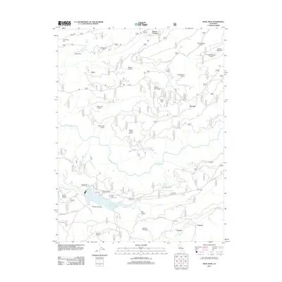
2012 Map of Devil Peak
USGS Topo · Published 2012About this map
Stumpy Meadows Lake dominates the southern landscape of this Placer County survey, surrounded by recreational points such as Stumpy Meadows Campground, Vista Camp, and Black Oak Campground. The area is defined by sharp topographic changes, from the heights of Devil Peak and Lookout Mountain to the deep incisions of Big Grizzly Canyon and Pigeon Roost Canyon. The Rubicon River winds through the central portion of the map, while Pilot Cr and Onion Cr drain the southern slopes.
Find a feature on this map
49 named features on this map. Tap any name to fly to it.
Don’t see what you’re looking for? This feature index may not catch every label — zoom into the map to look around manually.
Map Details
Editions of this 2012 Devil Peak Map
This is the sole edition of this map. No revisions or reprints were ever made.
Other maps of this area

1889 · Pyramid Peak
USGS Topo · 1:125,000

1891 · Colfax
USGS Topo · 1:125,000

1891 · Truckee
USGS Topo · 1:125,000

1891 · Placerville
USGS Topo · 1:125,000

1891 · Pyramid Peak
USGS Topo · 1:125,000

1892 · Placerville
USGS Topo · 1:125,000

1892 · Colfax
USGS Topo · 1:125,000

1893 · Placerville
USGS Topo · 1:125,000

1893 · Truckee
USGS Topo · 1:125,000

1894 · Colfax
USGS Topo · 1:125,000