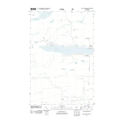
2011 Map of Devil Track Lake
USGS Topo · Published 2011About this map
Devil Track Lake serves as the central focal point of this North Shore landscape, where water and forest management define the local geography. The map documents a significant aviation infrastructure including the Grand Marais- Cook County Airport, the Sky Port Seaplane Base, and the Grand Marais- Devil Track Airport, reflecting the region's reliance on air travel for access to the backcountry. To the south, Murphy Mountain rises above the drainage of Rosebush Creek and the Fall River. The northern portion is dotted with numerous small water bodies such as Two Island Lake, Olso Lake, and Thompson Lake. Recreational and transit networks are well-established, noted by the Devil Lake Campground and forest routes like The Grade and Bally Creek Rd.
Find a feature on this map
34 named features on this map. Tap any name to fly to it.
Don’t see what you’re looking for? This feature index may not catch every label — zoom into the map to look around manually.
Map Details
Editions of this 2011 Devil Track Lake Map
This is the sole edition of this map. No revisions or reprints were ever made.
Other maps of this area

1919 · Brule Lake
USGS Topo · 1:62,500

1919 · Grand Marais
USGS Topo · 1:62,500

1919 · Lutsen
USGS Topo · 1:62,500

1954 · Two Harbors
USGS Topo · 1:250,000

1957 · Two Harbors
USGS Topo · 1:250,000

1958 · Two Harbors
USGS Topo · 1:250,000

1958 · Deer Yard Lake
USGS Topo · 1:24,000

1958 · Good Harbor Bay
USGS Topo · 1:24,000

1959 · Pine Mountain
USGS Topo · 1:24,000

1959 · Lima Mountain
USGS Topo · 1:24,000