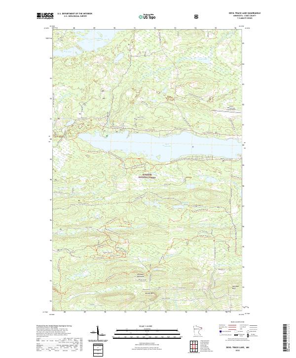
2022 Map of Devil Track Lake
USGS Topo · Published 2022About this map
Superior National Forest defines the character of this Minnesota landscape, where the Sawtooth Mountains rise above the north shore of Lake Superior. This 2022 survey captures a wilderness interface centered on Devil Track Lake, illustrating a complex network of recreational and resource-management infrastructure. The map documents an extensive system of trails and service roads, including the N Shore State Trl and the Devils Track Loop Trl, which navigate the elevation changes between Murphy Mtn and various glacial lakes. Evidence of local industry appears at the Nester Creek Pit, while the Grand Marais/Cook County Airport serves as a modern hub at the eastern edge of the quadrangle. The distribution of features like the Eagle Mountain Overlook Trl and Bally Creek reflects the area's contemporary role as a destination for hikers and outdoor enthusiasts within the national forest.
Find a feature on this map
73 named features on this map. Tap any name to fly to it.
Don’t see what you’re looking for? This feature index may not catch every label — zoom into the map to look around manually.
Map Details
Editions of this 2022 Devil Track Lake Map
This is the sole edition of this map. No revisions or reprints were ever made.
Other maps of this area

1919 · Brule Lake
USGS Topo · 1:62,500

1919 · Grand Marais
USGS Topo · 1:62,500

1919 · Lutsen
USGS Topo · 1:62,500

1954 · Two Harbors
USGS Topo · 1:250,000

1957 · Two Harbors
USGS Topo · 1:250,000

1958 · Two Harbors
USGS Topo · 1:250,000

1958 · Deer Yard Lake
USGS Topo · 1:24,000

1958 · Good Harbor Bay
USGS Topo · 1:24,000

1959 · Pine Mountain
USGS Topo · 1:24,000

1959 · Lima Mountain
USGS Topo · 1:24,000