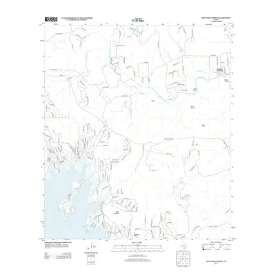
2013 Map of Devils Backbone
USGS Topo · Published 2013About this map
Canyon Lake dominates the southwestern quadrant of this Hill Country landscape, where residential developments like Canyon City and the Canyon Lake Airport have reshaped the terrain around the reservoir's north shore. The geography is defined by significant relief, featuring high points such as Baldy Mountain, Moon Mountain, and Tower Hill, alongside the prominent ridge of the Devils Backbone. This area preserves a mix of institutional and natural history, including the El Rancho Cima school and the historic Hugo Cem near the eastern boundary. The Blanco River snakes through the northern half of the quadrangle, crossed by local routes at Cloptins Crossing. Small drainages like Carpers Cr and Dutch Br carve through valleys such as Smith Hollow, illustrating the complex watershed system that feeds into the region's larger rivers and lakes.
Find a feature on this map
180 named features on this map. Tap any name to fly to it.
Don’t see what you’re looking for? This feature index may not catch every label — zoom into the map to look around manually.
Map Details
Editions of this 2013 Devils Backbone Map
This is the sole edition of this map. No revisions or reprints were ever made.
Other maps of this area

1887 · Blanco
USGS Topo · 1:125,000

1894 · Blanco
USGS Topo · 1:125,000

1920 · Smithsons Valley
USGS Topo · 1:62,500

1925 · Hunter No 3
USGS Topo · 1:48,000

1925 · Smithson Valley No. 1
USGS Topo · 1:48,000

1927 · Smithson Valley
USGS Topo · 1:62,500

1929 · Hunter
USGS Topo · 1:62,500

1929 · Smithson Valley
USGS Topo · 1:62,500

1940 · Smithson Valley
USGS Topo · 1:62,500

1954 · Llano
USGS Topo · 1:250,000