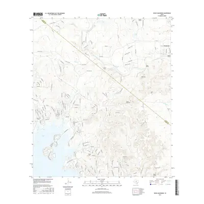
2016 Map of Devils Backbone
USGS Topo · Published 2016About this map
The Blanco River snakes through this Texas Hill Country landscape, defining the northern geography as it flows past Wimberley and several riverside developments. This 2016 survey illustrates a region shaped by its dramatic limestone topography, most notably the high ridge of the Devils Backbone and the peaks of Baldy Mtn and Tower Hill. The transition between the Blanco River basin and the southern reaches near Canyon Lake is marked by a network of residential pockets like Lonesome and Lakefield, alongside private aviation sites such as the 4 S Ranch Airport. For genealogists, the Hugo Cem remains a significant touchstone on the eastern edge of the survey. The map details a complex drainage system through numerous family-named valleys, including Heaton Hollow, Smith Hollow, and Shelton Hollow, illustrating how the modern road network follows the ancient contours of the terrain.
Find a feature on this map
156 named features on this map. Tap any name to fly to it.
Don’t see what you’re looking for? This feature index may not catch every label — zoom into the map to look around manually.
Map Details
Editions of this 2016 Devils Backbone Map
This is the sole edition of this map. No revisions or reprints were ever made.
Other maps of this area

1887 · Blanco
USGS Topo · 1:125,000

1894 · Blanco
USGS Topo · 1:125,000

1920 · Smithsons Valley
USGS Topo · 1:62,500

1925 · Hunter No 3
USGS Topo · 1:48,000

1925 · Smithson Valley No. 1
USGS Topo · 1:48,000

1927 · Smithson Valley
USGS Topo · 1:62,500

1929 · Hunter
USGS Topo · 1:62,500

1929 · Smithson Valley
USGS Topo · 1:62,500

1940 · Smithson Valley
USGS Topo · 1:62,500

1954 · Llano
USGS Topo · 1:250,000