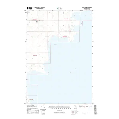
2014 Map of Devils Corner
USGS Topo · Published 2014About this map
Garden Peninsula defines this section of the Michigan coastline, where the land meets the vast expanse of Lake Michigan. The topography is characterized by a series of bays and inland lakes that suggest a landscape shaped by glacial activity and shifting shorelines. Small water bodies like Fishery Lake, Bog Lake, and Charboneau Lake are clustered near Portage Bay, while the interior remains sparsely developed. The settlement at Devils Corner serves as the primary landmark for this rural area, connected by a simple grid of local routes such as 14th Rd and LL Rd. The presence of Charboneau Point and the namesake Devils Corner reflects the localized naming conventions of Delta County's maritime and farming history, offering a detailed look at the peninsula's geography before further coastal development.
Find a feature on this map
23 named features on this map. Tap any name to fly to it.
Don’t see what you’re looking for? This feature index may not catch every label — zoom into the map to look around manually.
Map Details
Editions of this 2014 Devils Corner Map
This is the sole edition of this map. No revisions or reprints were ever made.
Other maps of this area

1932 · Burnt Bluff SW
USGS Topo · 1:31,680

1932 · Burnt Bluff NE
USGS Topo · 1:31,680

1932 · Burnt Bluff NW
USGS Topo · 1:31,680

1932 · Garden SE
USGS Topo · 1:31,680

1954 · Escanaba
USGS Topo · 1:250,000

1957 · Escanaba
USGS Topo · 1:250,000

1958 · Escanaba
USGS Topo · 1:250,000

1958 · Cooks
USGS Topo · 1:62,500

1958 · Garden
USGS Topo · 1:62,500

1958 · Fairport
USGS Topo · 1:62,500