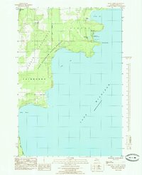
1985 Map of Devils Corner
USGS Topo · Published 1985About this map
The Garden Peninsula shoreline is meticulously detailed in this mid-1980s provisional study, illustrating a landscape defined by the Lake Superior State Forest and the transitional waters of Lake Michigan. The map focuses on the eastern edge of the peninsula, where the inland topography of Garden and Fairbanks townships meets the irregular coast. Named for its sharp bend in the local road network, Devils Corner serves as a navigational anchor near the northern boundary, while Gillnet Haven suggests a history tied to the regional fishing industry.
Find a feature on this map
19 named features on this map. Tap any name to fly to it.
Don’t see what you’re looking for? This feature index may not catch every label — zoom into the map to look around manually.
Map Details
Editions of this 1985 Devils Corner Map
This is the sole edition of this map. No revisions or reprints were ever made.
Other maps of this area

1932 · Burnt Bluff SW
USGS Topo · 1:31,680

1932 · Burnt Bluff NE
USGS Topo · 1:31,680

1932 · Burnt Bluff NW
USGS Topo · 1:31,680

1932 · Garden SE
USGS Topo · 1:31,680

1954 · Escanaba
USGS Topo · 1:250,000

1957 · Escanaba
USGS Topo · 1:250,000

1958 · Escanaba
USGS Topo · 1:250,000

1958 · Cooks
USGS Topo · 1:62,500

1958 · Garden
USGS Topo · 1:62,500

1958 · Fairport
USGS Topo · 1:62,500