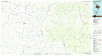
1985 Map of Devils Draw
USGS Topo · Published 1986About this map
The Pecos River and Devils River carve through the high limestone plateaus of Southwest Texas in this mid-1980s planimetric study. The map illustrates a landscape dominated by an intricate network of drainage systems, including the namesake Devils Draw, Howard Draw, and Big Canyon. Settlement is sparse, focused around isolated points like Pandale near the Pecos and Juno along TX 163. In the western portion of the map, the Southern Pacific RR cuts across the terrain near Terrell Station, following a route established long before these 1985 aerial revisions. Water sources are critical landmarks in this arid environment, represented by named features such as Meyers Spring, Scott Spring, and Packingham Spring. The map clearly delineates the convergence of Terrell, Crockett, and Val Verde counties, showing how ranch roads and state highways like U.S. 90 navigate the deeply dissected canyon country.
Find a feature on this map
102 named features on this map. Tap any name to fly to it.
Don’t see what you’re looking for? This feature index may not catch every label — zoom into the map to look around manually.
Map Details
Editions of this 1985 Devils Draw Map
2 editions found
Other maps of this area

1918 · Dryden Crossing
USGS Topo · 1:62,500

1928 · Sanderson
USGS Topo · 1:125,000

1929 · Sheffield
USGS Topo · 1:125,000

1929 · Independence Draw Quadrangle
USGS Topo · 1:125,000

1943 · Malvado
USGS Topo · 1:62,500

1943 · Langtry
USGS Topo · 1:62,500

1943 · Shumla
USGS Topo · 1:62,500

1944 · Dry Devil
USGS Topo · 1:62,500

1944 · Malvado
USGS Topo · 1:62,500

1944 · Baker Crossing
USGS Topo · 1:62,500