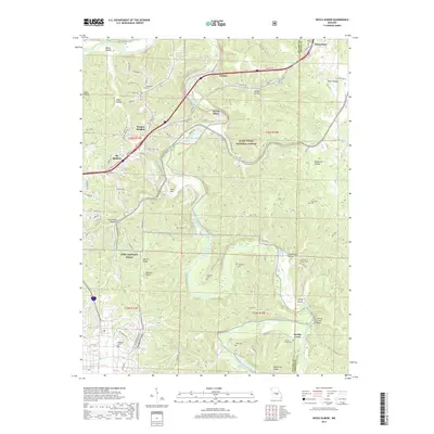
2017 Map of Devils Elbow
USGS Topo · Published 2017About this map
St. Robert and the sprawling training grounds of Fort Leonard Wood anchor this portion of the Ozark Plateau, where the rugged topography of the Mark Twain National Forest meets significant historical transit corridors. The Big Piney River winds through the center of the sheet, creating the sharp bend that gives Devils Elbow its name. This area is defined by its deep karst features and hollows, such as Smoky Hollow and Round Pond Hollow, which provided the secluded sites for numerous family burial grounds including Mayfield Cem and Thompson Cem.
Find a feature on this map
99 named features on this map. Tap any name to fly to it.
Don’t see what you’re looking for? This feature index may not catch every label — zoom into the map to look around manually.
Map Details
Editions of this 2017 Devils Elbow Map
This is the sole edition of this map. No revisions or reprints were ever made.
Other maps of this area

1912 · Rolla
USGS Topo · 1:62,500

1936 · Waynesville
USGS Topo · 1:48,000

1937 · Edgar Springs
USGS Topo · 1:48,000

1941 · Big Piney
USGS Topo · 1:62,500

1942 · Waynesville
USGS Topo · 1:62,500

1943 · Big Piney
USGS Topo · 1:62,500

1944 · Waynesville
USGS Topo · 1:62,500

1945 · Edgar Springs
USGS Topo · 1:62,500

1949 · Rolla
USGS Topo · 1:250,000

1950 · Newburg
USGS Topo · 1:24,000