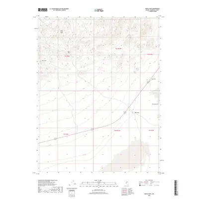
2018 Map of Devils Gate
USGS Topo · Published 2018About this map
Monte Cristo Range dominates the northern landscape of this Esmeralda County quadrangle, where the high desert terrain transitions sharply into the expansive Big Smoky Valley to the southeast. The geography is punctuated by distinctive geological landmarks such as Castle Peak and the namesake Devils Gate pass. Near the intersection of the desert floor and the rising slopes of the range, McLeans serves as a lone named point of human presence along the highway route crossing the basin. The map reveals a high-elevation environment defined by steep contour lines near Black Rock contrasted with the broad, open alluvial flats of the valley, documenting the remote character of central Nevada's basin-and-range province in the late 2010s.
Find a feature on this map
12 named features on this map. Tap any name to fly to it.
Don’t see what you’re looking for? This feature index may not catch every label — zoom into the map to look around manually.
Map Details
Editions of this 2018 Devils Gate Map
This is the sole edition of this map. No revisions or reprints were ever made.
Other maps of this area

1898 · Silver Peak
USGS Topo · 1:125,000

1900 · Silver Peak
USGS Topo · 1:125,000

1907 · Tonopah
USGS Topo · 1:250,000

1908 · Lida
USGS Topo · 1:250,000

1908 · Tonopah
USGS Topo · 1:250,000

1913 · Lida
USGS Topo · 1:250,000

1954 · Goldfield
USGS Topo · 1:250,000

1955 · Goldfield
USGS Topo · 1:250,000

1956 · Tonopah
USGS Topo · 1:250,000

1958 · Goldfield
USGS Topo · 1:250,000