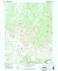
1983 Map of Devils Hole
USGS Topo · Published 1995About this map
The San Rafael River carves through the heart of this high-desert plateau, winding its way through the distinct geological formations of the Indian Bench. This landscape is defined by its deep drainages and named canyon systems, including the split paths of West Fork and East Fork which meet near the central Devils Hole. Evidence of human activity is scattered and specific to the era's land use, featuring a single Prospect and a Drill Hole alongside isolated livestock infrastructure like a Corral and various 4wd routes. The nomenclature of the terrain reflects early ranching and travel, with descriptive labels such as The Pack Saddle, Jackass Flat, and the Moonshine Waterhole. To the south, the river enters the tight narrows of the Black Box, a significant landmark for those tracing the historical hydrology and passage through this portion of Emery County.
Find a feature on this map
30 named features on this map. Tap any name to fly to it.
Don’t see what you’re looking for? This feature index may not catch every label — zoom into the map to look around manually.
Map Details
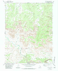
Editions of this 1983 Devils Hole Map
2 editions found
Other maps of this area

1885 · San Rafael
USGS Topo · 1:250,000

1886 · Price River
USGS Topo · 1:250,000

1896 · Price River
USGS Topo · 1:250,000

1953 · Red Plateau SE
USGS Topo · 1:24,000

1953 · Red Plateau SW
USGS Topo · 1:24,000

1953 · Beckwith Peak SW
USGS Topo · 1:24,000

1953 · Tidwell 2 NW
USGS Topo · 1:24,000

1954 · Stinking Spring Creek 1 NW
USGS Topo · 1:24,000

1954 · Stinking Spring Creek 1 NE
USGS Topo · 1:24,000

1954 · Tidwell Bottoms
USGS Topo · 1:62,500