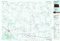
1985 Map of Devils Lake
USGS Topo · Published 1985About this map
Devils Lake serves as the focal point of this North Dakota landscape, surrounded by an intricate network of wetlands and coulees including Starkweather Coulee and Edmore Coulee. The map illustrates a region heavily managed for conservation, notably through numerous National Waterfowl Production Areas and the Pioneer Lake National Wildlife Refuge. These protected zones are interwoven with small agricultural hubs and rail lines like the Burlington Northern and Soo Line, reflecting the dual priorities of the mid-1980s: intensive grain transport and environmental stewardship.
Find a feature on this map
65 named features on this map. Tap any name to fly to it.
Don’t see what you’re looking for? This feature index may not catch every label — zoom into the map to look around manually.
Map Details
Editions of this 1985 Devils Lake Map
This is the sole edition of this map. No revisions or reprints were ever made.
Other maps of this area

1928 · Tokio
USGS Topo · 1:62,500

1930 · Pekin
USGS Topo · 1:62,500

1930 · Hamar
USGS Topo · 1:62,500

1931 · Oberon
USGS Topo · 1:62,500

1931 · Tokio
USGS Topo · 1:62,500

1931 · Devils Lake
USGS Topo · 1:62,500

1932 · Grahams Island
USGS Topo · 1:62,500

1939 · Niagara
USGS Topo · 1:62,500

1942 · McVille
USGS Topo · 1:62,500

1950 · Tokio
USGS Topo · 1:24,000