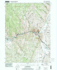
1997 Map of Devils Slide
USGS Topo · Published 2001About this map
Henefer Valley serves as a focal point for this late-1990s topographical study, where the Weber River carves through the transition between Round Valley and the Upper Weber Canyon. The landscape is a mix of agricultural settlement and heavy industry, most notably at the cement plant near Croydon. Transportation history is layered throughout the corridor, from the modern infrastructure around Taggarts to the historic route of the Mormon Pioneers trailing along the river's path. Local community life in Henefer is detailed through landmarks like the Rodeo Ground, Flume Park, and the local cemetery. Higher elevations are defined by the prominent Folley Ridge and a network of deep drainages such as Cottonwood Canyon and Oak Spring Canyon, many of which show evidence of resource extraction via various labeled quarries.
Find a feature on this map
43 named features on this map. Tap any name to fly to it.
Don’t see what you’re looking for? This feature index may not catch every label — zoom into the map to look around manually.
Map Details
Editions of this 1997 Devils Slide Map
This is the sole edition of this map. No revisions or reprints were ever made.
Other maps of this area

1885 · Salt Lake
USGS Topo · 1:250,000

1900 · Coalville
USGS Topo · 1:125,000

1903 · Coalville
USGS Topo · 1:125,000

1925 · Ft. Douglas
USGS Topo · 1:125,000

1928 · Ft. Douglas
USGS Topo · 1:125,000

1954 · Salt Lake City
USGS Topo · 1:250,000

1954 · Ogden
USGS Topo · 1:250,000

1958 · Ogden
USGS Topo · 1:250,000

1958 · Salt Lake City
USGS Topo · 1:250,000

1960 · Ogden
USGS Topo · 1:250,000