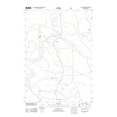
2012 Map of Devils Tower
USGS Topo · Published 2012About this map
Devils Tower National Monument dominates this northeast Wyoming landscape, where the iconic igneous monolith of Devils Tower rises above the meandering Belle Fourche River. The 2012 topography illustrates a region defined by high ridges and drainage basins, including Tower Divide and Brimmer Divide, which separate the various creeks feeding the river system. Settlement patterns are sparse, centered around established rural holdings such as Campstool Ranch and Pic Ranch. To the south, Carlile Junction serves as a local transit point, connecting the river valley to the broader Crook County road network. Geologic features like Campstool Draw and watercourses such as Lytle Cr and Miller Cr highlight the erosional forces that have shaped the territory surrounding the United States' first national monument.
Find a feature on this map
25 named features on this map. Tap any name to fly to it.
Don’t see what you’re looking for? This feature index may not catch every label — zoom into the map to look around manually.
Map Details
Editions of this 2012 Devils Tower Map
This is the sole edition of this map. No revisions or reprints were ever made.
Other maps of this area

1905 · Devils Tower
USGS Topo · 1:125,000

1918 · Moorcroft
USGS Topo · 1:125,000

1918 · Moorcroft
USGS Topo · 1:62,500

1954 · Sunny Divide
USGS Topo · 1:24,000

1954 · Storm Hill
USGS Topo · 1:24,000

1954 · Carlile
USGS Topo · 1:24,000

1954 · Missouri Buttes
USGS Topo · 1:24,000

1954 · Gillette
USGS Topo · 1:250,000

1955 · Devils Tower
USGS Topo · 1:62,500

1955 · Gillette
USGS Topo · 1:250,000