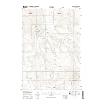
2015 Map of Devils Tower
USGS Topo · Published 2015About this map
Devils Tower stands as the central landmark of this Crook County landscape, surrounded by the federally protected acreage of the Devils Tower National Monument. The terrain is defined by the winding course of the Belle Fourche River as it cuts through the valley floor, while several drainage systems like Lytle Cr and Campstool Draw carve into the surrounding uplands. A network of hiking paths including the Joyner Ridge Trail, Red Beds Trail, and Tower Trail circle the iconic igneous intrusion, illustrating the modern recreational infrastructure of the monument.
Find a feature on this map
35 named features on this map. Tap any name to fly to it.
Don’t see what you’re looking for? This feature index may not catch every label — zoom into the map to look around manually.
Map Details
Editions of this 2015 Devils Tower Map
This is the sole edition of this map. No revisions or reprints were ever made.
Other maps of this area

1905 · Devils Tower
USGS Topo · 1:125,000

1918 · Moorcroft
USGS Topo · 1:125,000

1918 · Moorcroft
USGS Topo · 1:62,500

1954 · Sunny Divide
USGS Topo · 1:24,000

1954 · Storm Hill
USGS Topo · 1:24,000

1954 · Carlile
USGS Topo · 1:24,000

1954 · Missouri Buttes
USGS Topo · 1:24,000

1954 · Gillette
USGS Topo · 1:250,000

1955 · Devils Tower
USGS Topo · 1:62,500

1955 · Gillette
USGS Topo · 1:250,000