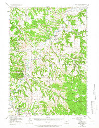
1955 Map of Devils Tower
USGS Topo · Published 1966About this map
Devils Tower National Monument dominates this mid-century Wyoming landscape, showcasing the iconic Devils Tower igneous intrusion rising above the Belle Fourche River. The map reveals a remote ranching and timber geography defined by high divides and deep canyons, including the Brimmer Divide and Tower Divide. Rural education is remarkably dense for the period, with numerous one-room schoolhouses such as the Moore Hill Sch, Campstool Sch, and Russell Sch serving isolated homesteads. The town of Hulett serves as the local hub, featuring a gaging station and the Hulett Cem. Settlement patterns follow the river and its tributaries like Lytle Creek, where family-named operations like the Devils Tower Ranch and Pic Ranch were established before the modernization of the local road network.
Find a feature on this map
47 named features on this map. Tap any name to fly to it.
Don’t see what you’re looking for? This feature index may not catch every label — zoom into the map to look around manually.
Map Details
Editions of this 1955 Devils Tower Map
2 editions found

Other maps of this area

1898 · Sundance
USGS Topo · 1:125,000

1901 · Aladdin
USGS Topo · 1:125,000

1902 · Sundance
USGS Topo · 1:125,000

1903 · Aladdin
USGS Topo · 1:125,000

1905 · Devils Tower
USGS Topo · 1:125,000

1918 · Moorcroft
USGS Topo · 1:125,000

1918 · Moorcroft
USGS Topo · 1:62,500

1954 · Sunny Divide
USGS Topo · 1:24,000

1954 · Strawberry Hill
USGS Topo · 1:24,000

1954 · Storm Hill
USGS Topo · 1:24,000