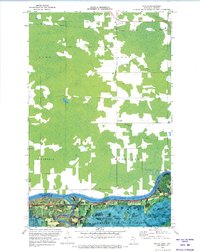
1970 Map of Devlin
USGS Topo · Published 1973About this map
The Rainy River forms a wide, international boundary between Ontario and Minnesota in this 1970 orthophotomap, showing the binational character of the northern frontier. While the northern half of the sheet is dominated by the Canadian National railroad and the township of Devlin, the southern section features the dense timberlands of the Smokey Bear State Forest. The topography is distinctly low-lying, shaped by the confluence where the Big Fork River joins the Rainy.
Find a feature on this map
21 named features on this map. Tap any name to fly to it.
Don’t see what you’re looking for? This feature index may not catch every label — zoom into the map to look around manually.
Map Details
Editions of this 1970 Devlin Map
This is the sole edition of this map. No revisions or reprints were ever made.
Other maps of this area
1919 · Pelland
USGS Topo · 1:62,500
1919 · Happy Land
USGS Topo · 1:62,500
1943 · Lindford
USGS Topo · 1:62,500
1954 · International Falls
USGS Topo · 1:250,000
1957 · International Falls
USGS Topo · 1:250,000
1958 · International Falls
USGS Topo · 1:250,000
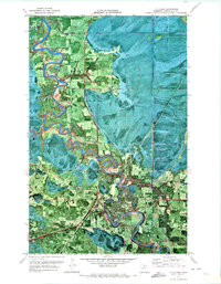
1970 · Littlefork
USGS Topo · 1:24,000
1970 · Lindford
USGS Topo · 1:24,000
1970 · Pelland
USGS Topo · 1:24,000
1970 · Littlefork NW
USGS Topo · 1:24,000