
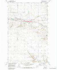
1970 Map of Devon
USGS Topo · Published 1973About this map
Devon serves as the central hub of this northern Montana landscape, situated along the Burlington Northern line. The topography is defined by a network of drainage systems, including Willow Creek and the West Fork Willow Creek, which cut through the high plains. Of particular interest to transport historians is the Old Railroad Grade north of the active tracks, showing an earlier alignment of the transcontinental route through Toole County. This 1970s survey captures the region as part of the Department of the Interior's Missouri River Basin development program, documenting a transition from the railway's industrial footprint to the remote coulees like Coyote Coulee and Edmister Coulee. The presence of East Road and scattered benchmarks like Devon (BM 3109) provide essential reference points for genealogists and local historians tracking rural land use in this section of the state.
Find a feature on this map
11 named features on this map. Tap any name to fly to it.
Don’t see what you’re looking for? This feature index may not catch every label — zoom into the map to look around manually.
Map Details
Editions of this 1970 Devon Map
2 editions found
Other maps of this area

1920 · Conrad
USGS Topo · 1:125,000

1943 · Antelope Coulee
USGS Topo · 1:62,500

1954 · Shelby
USGS Topo · 1:250,000

1958 · Shelby
USGS Topo · 1:250,000

1962 · Mc Carters Lake
USGS Topo · 1:24,000

1962 · Mc Carters Lake SE
USGS Topo · 1:24,000

1967 · Central School
USGS Topo · 1:24,000

1967 · South Devon School
USGS Topo · 1:24,000

1970 · Pondera School
USGS Topo · 1:24,000

1970 · Galata
USGS Topo · 1:24,000