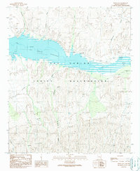
1989 Map of Dewey Flat
USGS Topo · Published 1990About this map
The San Carlos Reservoir dominates this landscape within the San Carlos Indian Reservation, capturing the Gila River behind the engineering of the nearby dam. This late 1980s survey illustrates a rugged desert environment where water management and transportation are the primary human imprints. The Coolidge Dam Road provides access through the southern uplands, while a prominent pipeline traverses the northern and central terrain near Natches.
Find a feature on this map
21 named features on this map. Tap any name to fly to it.
Don’t see what you’re looking for? This feature index may not catch every label — zoom into the map to look around manually.
Map Details
Editions of this 1989 Dewey Flat Map
This is the sole edition of this map. No revisions or reprints were ever made.
Other maps of this area

1954 · Mesa
USGS Topo · 1:250,000

1957 · Mesa
USGS Topo · 1:250,000

1958 · Mesa
USGS Topo · 1:250,000

1960 · Mesa
USGS Topo · 1:250,000

1960 · Bylas
USGS Topo · 1:62,500

1962 · San Carlos Reservoir
USGS Topo · 1:62,500

1964 · Mesa
USGS Topo · 1:250,000

1966 · Branaman Spring
USGS Topo · 1:24,000
1966 · Mount Triplet
USGS Topo · 1:24,000
1966 · San Carlos
USGS Topo · 1:24,000