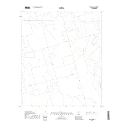
2019 Map of Dewey Lake SE
USGS Topo · Published 2019About this map
Lacy Cr and the topographic depression of Lacy Draw define the drainage patterns of this rural landscape in Glasscock County. The terrain is characterized by a network of ranching and county roads that grid the territory, including Co Rd 110 and Co Rd 125, which provide access to the various livestock and agricultural holdings in this part of the Permian Basin. This survey illustrates the modern layout of the high plains, where the land is partitioned into large rectangular blocks. The absence of traditional townsites highlights the region's focus on wide-scale land use, with secondary routes like Co Rd 130 and Co Op Rd serving as the primary infrastructure for local movement across the draws and rises.
Find a feature on this map
11 named features on this map. Tap any name to fly to it.
Don’t see what you’re looking for? This feature index may not catch every label — zoom into the map to look around manually.
Map Details
Editions of this 2019 Dewey Lake SE Map
This is the sole edition of this map. No revisions or reprints were ever made.
Other maps of this area

1954 · San Angelo
USGS Topo · 1:250,000

1958 · San Angelo
USGS Topo · 1:250,000

1963 · Ballinger Ranch
USGS Topo · 1:24,000

1963 · Garden City
USGS Topo · 1:24,000

1964 · Dewey Lake NE
USGS Topo · 1:24,000

1965 · San Angelo
USGS Topo · 1:250,000

1965 · Dewey Lake
USGS Topo · 1:24,000

1965 · Dewey Lake SE
USGS Topo · 1:24,000

1965 · Patterson Lake
USGS Topo · 1:24,000

1973 · Bigby Corner
USGS Topo · 1:24,000