
1963 Map of Garden City
USGS Topo · Published 1965About this map
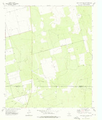
Garden City serves as the focal point of this West Texas landscape during the early 1960s, situated at the junction of regional thoroughfares. The settlement's layout is clearly defined, with the Garden City Cem located just to the south, providing a key point of reference for genealogists and local historians. The surrounding terrain is characterized by a network of ephemeral watercourses and draws, including Lacy Creek and Polecat Draw, which dictate the placement of ranching operations like the Currie Ranch in the northeast. Several Gravel Pits scattered across the quadrangle indicate the importance of local material extraction for road building and infrastructure in this semi-arid region. The presence of Roadside Park along the highway highlights the mid-century development of traveler amenities in Glasscock County, while the converging branches of Apple Creek and the East Fork define the eastern drainage patterns.
Find a feature on this map
10 named features on this map. Tap any name to fly to it.
Don’t see what you’re looking for? This feature index may not catch every label — zoom into the map to look around manually.
Map Details
Editions of this 1963 Garden City Map
This is the sole edition of this map. No revisions or reprints were ever made.
Other maps of this area

1954 · San Angelo
USGS Topo · 1:250,000

1958 · San Angelo
USGS Topo · 1:250,000

1963 · Ballinger Ranch
USGS Topo · 1:24,000

1963 · Currie Reservoir
USGS Topo · 1:24,000

1963 · Garden City NE
USGS Topo · 1:24,000

1964 · Dewey Lake NE
USGS Topo · 1:24,000

1965 · San Angelo
USGS Topo · 1:250,000

1965 · Dewey Lake SE
USGS Topo · 1:24,000

1973 · Three Bluff Draw NE
USGS Topo · 1:24,000
1973 · Three Bluff Draw NW
USGS Topo · 1:24,000