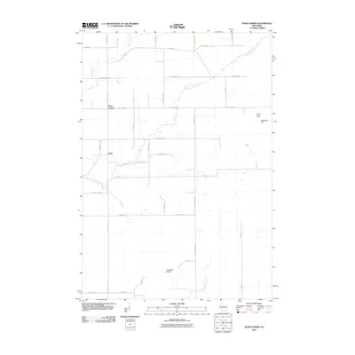
2010 Map of Dewey Marsh
USGS Topo · Published 2010About this map
The Little Eau Claire River winds through this central Wisconsin landscape, defining the rural character of an area dotted with small settlements and agricultural crossings. Small communities like Rocky Corners and Ashley serve as local hubs, connected by a network of roads such as County Hwy-X and County Hwy-C. The terrain transitions from the marshy lowlands near Johnson Creek to the distinct elevation of Blackberry Hill in the east, which features the Quarry Lookout Tower. An unusual local naming convention is evident in the southern portion of the quadrangle with the labeled Philippine Islands, an area bounded by the meandering Hay Meadow Creek. This survey captures the region as a patchwork of woodlands and managed fields just before the turn of the decade, preserving the layout of family-named routes like Zoromski Rd and Cisewski Rd.
Find a feature on this map
40 named features on this map. Tap any name to fly to it.
Don’t see what you’re looking for? This feature index may not catch every label — zoom into the map to look around manually.
Map Details
Editions of this 2010 Dewey Marsh Map
This is the sole edition of this map. No revisions or reprints were ever made.
Other maps of this area

1899 · Wausau
USGS Topo · 1:125,000

1902 · Wausau
USGS Topo · 1:125,000

1953 · Wausau
USGS Topo · 1:48,000

1953 · Hatley
USGS Topo · 1:48,000

1955 · Rosholt
USGS Topo · 1:48,000

1955 · Green Bay
USGS Topo · 1:250,000

1956 · Stevens Point
USGS Topo · 1:48,000

1963 · Wausau
USGS Topo · 1:62,500

1964 · Hatley
USGS Topo · 1:62,500

1969 · Rosholt NW
USGS Topo · 1:24,000