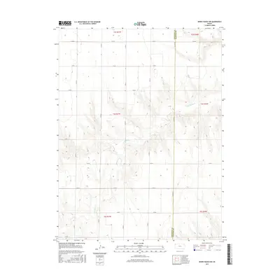
2015 Map of Dewey Ranch NW
USGS Topo · Published 2015About this map
Little Beaver Creek carves a winding path across this High Plains landscape, defining the local topography where the High Plains meet the headwaters of the Republican River basin. In this sparsely populated corner of Northwest Kansas, the cartography is dominated by the rigid geometry of the Public Land Survey System, with township and range lines like t4s r37w and t4s r36w organizing the terrain. The map captures the interface between Cheyenne and Rawlins Counties, a boundary physically manifested by County Line Road. This section of the Great Plains is knit together by a meticulous grid of rural routes, from County Road M in the north down to County Road E, illustrating the late-modern infrastructure that supports the region's agricultural life and cattle ranching economy.
Find a feature on this map
21 named features on this map. Tap any name to fly to it.
Don’t see what you’re looking for? This feature index may not catch every label — zoom into the map to look around manually.
Map Details
Editions of this 2015 Dewey Ranch NW Map
This is the sole edition of this map. No revisions or reprints were ever made.
Other maps of this area

1950 · Mc Donald
USGS Topo · 1:62,500

1951 · Bird City North
USGS Topo · 1:62,500

1951 · Mc Donald
USGS Topo · 1:62,500

1951 · Bird City South
USGS Topo · 1:62,500

1951 · Dewey Ranch
USGS Topo · 1:62,500

1954 · Goodland
USGS Topo · 1:250,000

1956 · Goodland
USGS Topo · 1:250,000

1957 · Goodland
USGS Topo · 1:250,000

1976 · Bird City North
USGS Topo · 1:24,000
1978 · Mc Donald SW
USGS Topo · 1:24,000