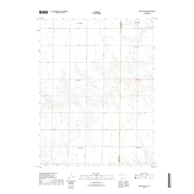
2018 Map of Dewey Ranch NW
USGS Topo · Published 2018About this map
The High Plains landscape of Northwest Kansas is defined here by the winding course of Little Beaver Cr as it carves through the shortgrass prairie. Stretching across the border between Cheyenne County and Rawlins County, this area remains characterized by a sparse, grid-based network of rural routes such as Co Rd M and Co Rd G. The terrain is marked by deep drainage patterns and breaks that reveal the region's underlying geology, contrasting with the flat agricultural sections of the upland. A notable point of human activity in this otherwise open territory is the Goltl Airport, which provides a landing strip for local aviation north of the creek. This survey illustrates the persistent ranching and farming structure of the modern era, where large land tracts are organized by the Public Land Survey System into townships like t4s r37w.
Find a feature on this map
17 named features on this map. Tap any name to fly to it.
Don’t see what you’re looking for? This feature index may not catch every label — zoom into the map to look around manually.
Map Details
Editions of this 2018 Dewey Ranch NW Map
This is the sole edition of this map. No revisions or reprints were ever made.
Other maps of this area

1950 · Mc Donald
USGS Topo · 1:62,500

1951 · Bird City North
USGS Topo · 1:62,500

1951 · Mc Donald
USGS Topo · 1:62,500

1951 · Bird City South
USGS Topo · 1:62,500

1951 · Dewey Ranch
USGS Topo · 1:62,500

1954 · Goodland
USGS Topo · 1:250,000

1956 · Goodland
USGS Topo · 1:250,000

1957 · Goodland
USGS Topo · 1:250,000

1976 · Bird City North
USGS Topo · 1:24,000
1978 · Mc Donald SW
USGS Topo · 1:24,000