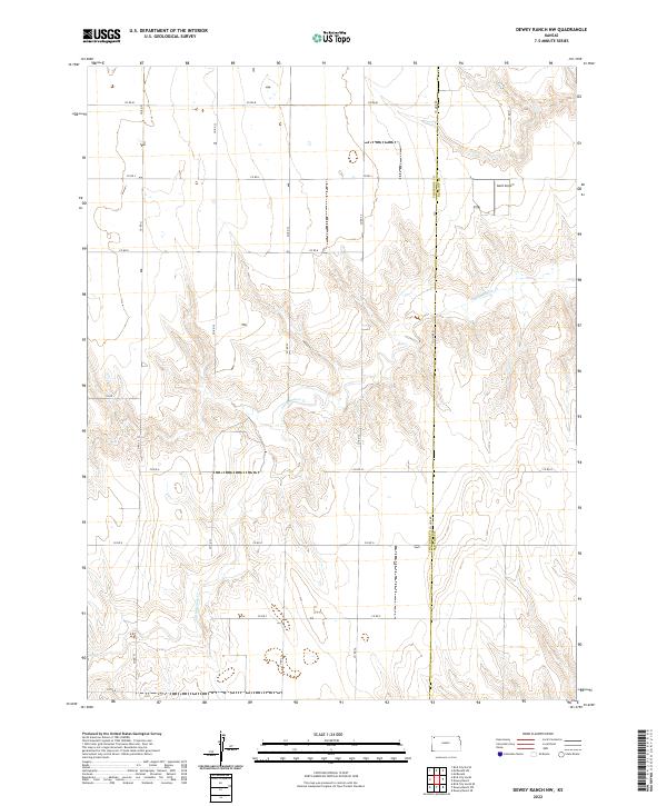
2022 Map of Dewey Ranch NW
USGS Topo · Published 2022About this map
The high plains of Cheyenne County and Rawlins County meet in this corner of Northwest Kansas, where the winding drainage of Little Beaver Cr cuts through the shortgrass prairie. The terrain is defined by the sharp contrast between the flat upland agricultural plateaus and the dissected breaks leading down to the creek bed. This 2022 survey illustrates a landscape of wide-open ranching and farming operations organized by a rigid grid of section-line roads, including Co Rd M and Co Rd E. A notable modern landmark in this remote territory is the Goltl Airport, situated just east of the Cheyenne Co Rawlins Co border. The map provides a clear look at the township and range system, marking boundaries for t4s r37w and surrounding blocks, which remains the primary orientation for local landownership and agricultural management today.
Find a feature on this map
22 named features on this map. Tap any name to fly to it.
Don’t see what you’re looking for? This feature index may not catch every label — zoom into the map to look around manually.
Map Details
Editions of this 2022 Dewey Ranch NW Map
This is the sole edition of this map. No revisions or reprints were ever made.
Other maps of this area

1950 · Mc Donald
USGS Topo · 1:62,500

1951 · Bird City North
USGS Topo · 1:62,500

1951 · Mc Donald
USGS Topo · 1:62,500

1951 · Bird City South
USGS Topo · 1:62,500

1951 · Dewey Ranch
USGS Topo · 1:62,500

1954 · Goodland
USGS Topo · 1:250,000

1956 · Goodland
USGS Topo · 1:250,000

1957 · Goodland
USGS Topo · 1:250,000

1976 · Bird City North
USGS Topo · 1:24,000
1978 · Mc Donald SW
USGS Topo · 1:24,000