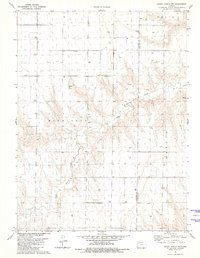
1981 Map of Dewey Ranch NW
USGS Topo · Published 1981About this map
Little Beaver Creek carves a winding path through the high plains of northwest Kansas on this 1981 survey, defining the rugged breaks between the flat upland plateaus. The landscape is primarily shaped by the transition between Cheyenne and Rawlins counties, where the terrain is marked by broad ridges like Bird City, Celia, and Rotate. While the area is largely rural, the presence of numerous Well sites and a Quarry in the eastern hills suggests a landscape tied closely to resource extraction and agricultural development. The intricate contour work reveals the complex drainage patterns feeding into the creek bed, a stark contrast to the straight section lines that organize the surrounding prairies.
Find a feature on this map
7 named features on this map. Tap any name to fly to it.
Don’t see what you’re looking for? This feature index may not catch every label — zoom into the map to look around manually.
Map Details
Editions of this 1981 Dewey Ranch NW Map
This is the sole edition of this map. No revisions or reprints were ever made.
Other maps of this area

1950 · Mc Donald
USGS Topo · 1:62,500

1951 · Bird City North
USGS Topo · 1:62,500

1951 · Mc Donald
USGS Topo · 1:62,500

1951 · Bird City South
USGS Topo · 1:62,500

1951 · Dewey Ranch
USGS Topo · 1:62,500

1954 · Goodland
USGS Topo · 1:250,000

1956 · Goodland
USGS Topo · 1:250,000

1957 · Goodland
USGS Topo · 1:250,000

1976 · Bird City North
USGS Topo · 1:24,000
1978 · Mc Donald SW
USGS Topo · 1:24,000